Airport Tarmac Safety Initiative Takes Off with Precise GIS Mapping Data from ROMDAS and Applanix POS LVX
According to an industry study* of Runway Safety from Insight SRI, Ltd, FOD’s have an estimated cost impact of $13B on the aerospace industry. The impact of FOD on the aerospace industry cannot be overstated. FOD detection and collection requires numerous man-hours draining both resources and finances.
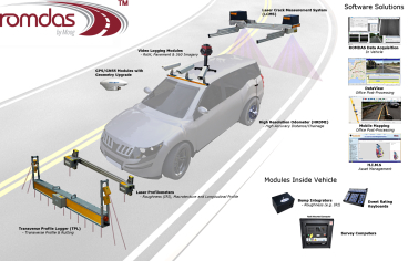
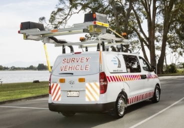
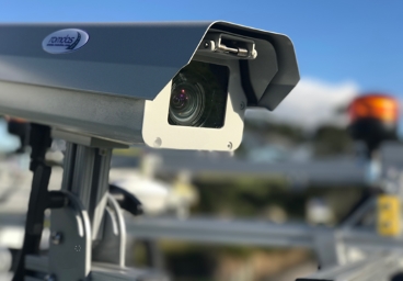
To help mitigate this, DCL has collaborated with Pavemetrics and Trimble to develop an integrated FOD detection surveying system – ROMDAS LFOD system – using high-resolution LCMS scanners and high-accuracy Applanix POS LVX.
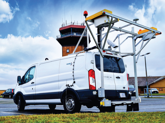
Our aim is to provide affordable road surveying capabilities that can be used to improve road safety around the world. The integrated ROMDAS LFOD system can improve airport tarmac surveying and provide retrieval guidance for any found debris. Additionally, the same inspections can now be performed within a couple of hours and less human resources, creating a huge financial and resource savings.
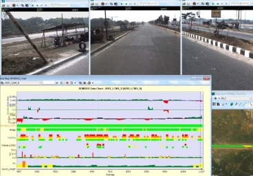
ROMDAS LFOD also allows for a collection of a wide variety of pavement condition data and makes it an ideal solution for small and medium-sized airports The ROMDAS LCMS with LFOD delivers versatility and cost efficiencies as both a debris detection and pavement management system.
Read the complete case study to know the true impact of this ROMDAS LFOD system
*Source: ”The Economic Cost of FOD to Airlines’’, Insight SRI Ltd., March 2008.