Right of Way Video & Mobile Mapping
A visual record of the road corridor for right-of-way
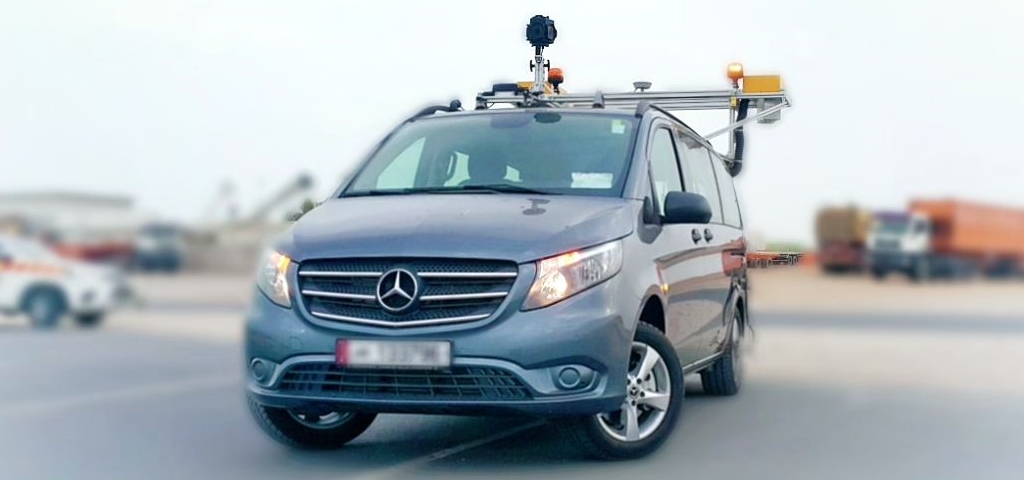
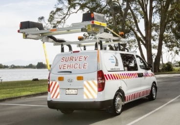
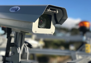
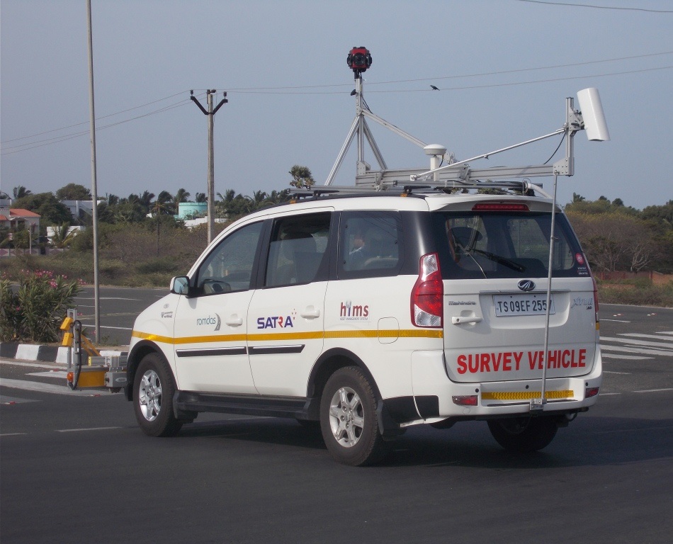
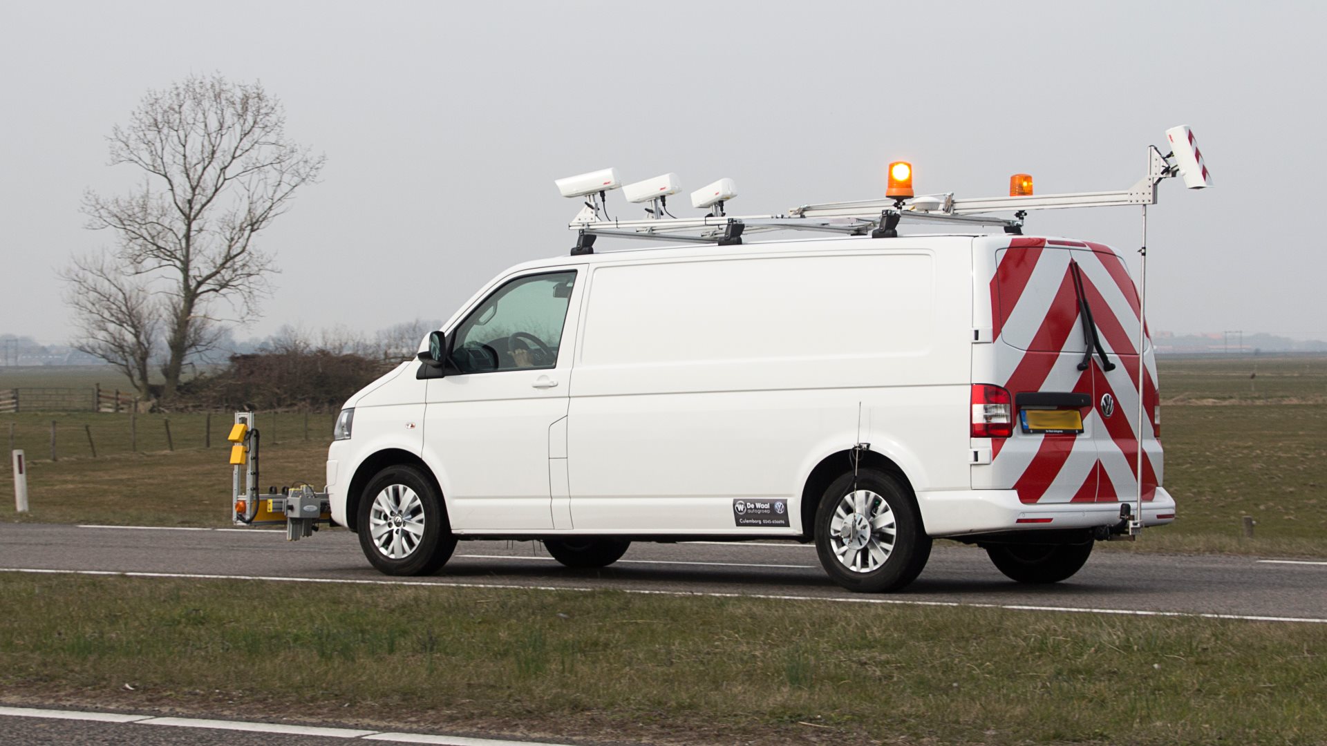
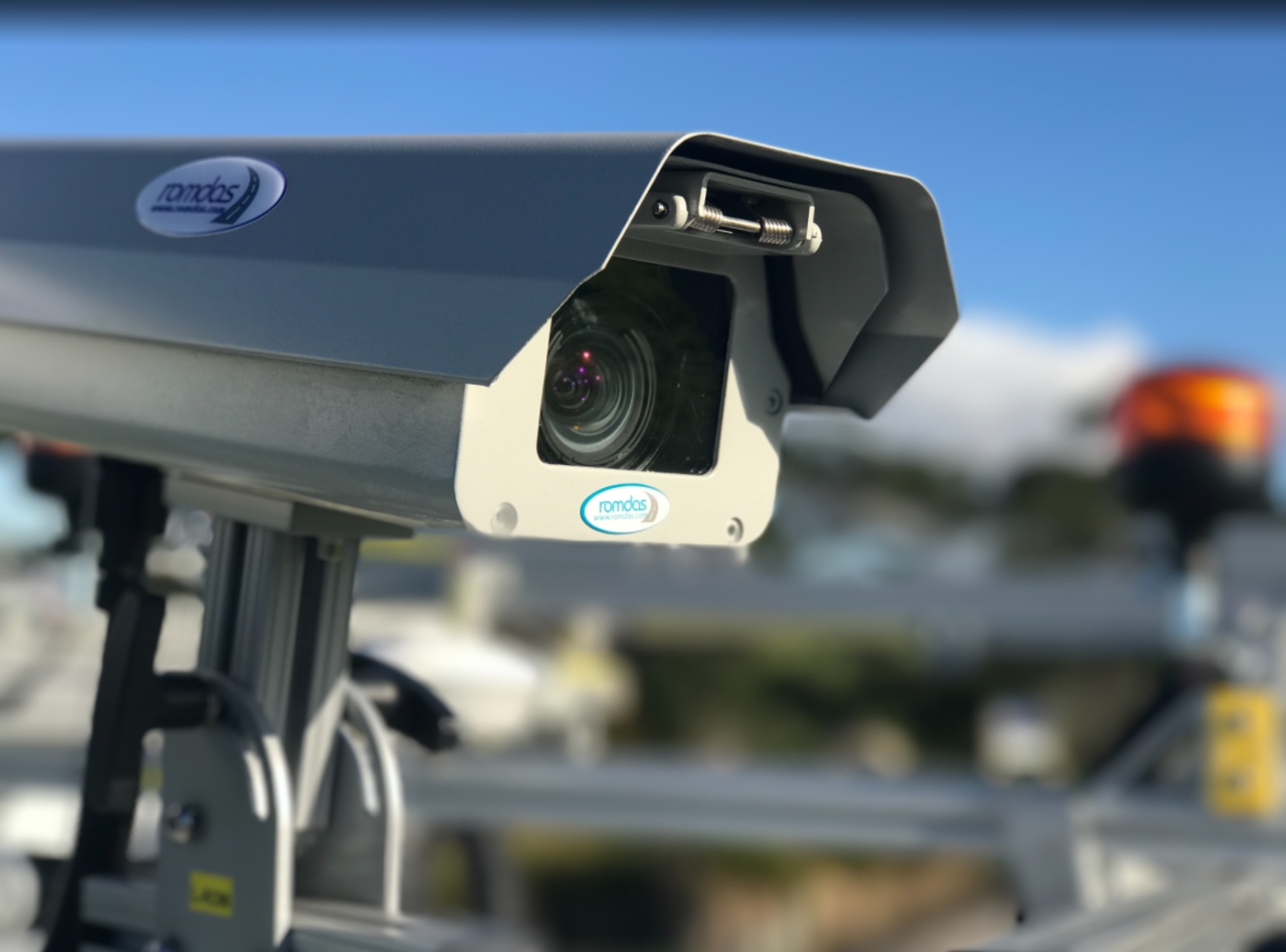
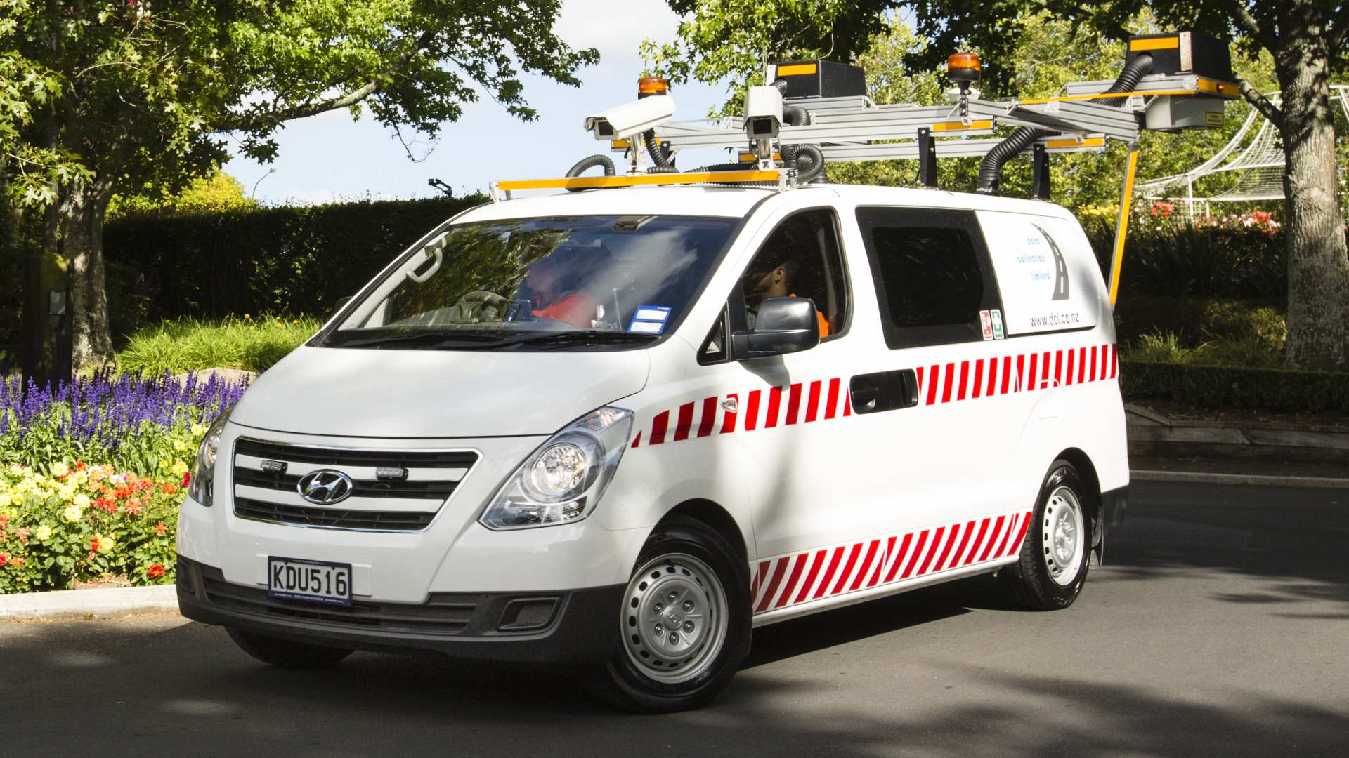
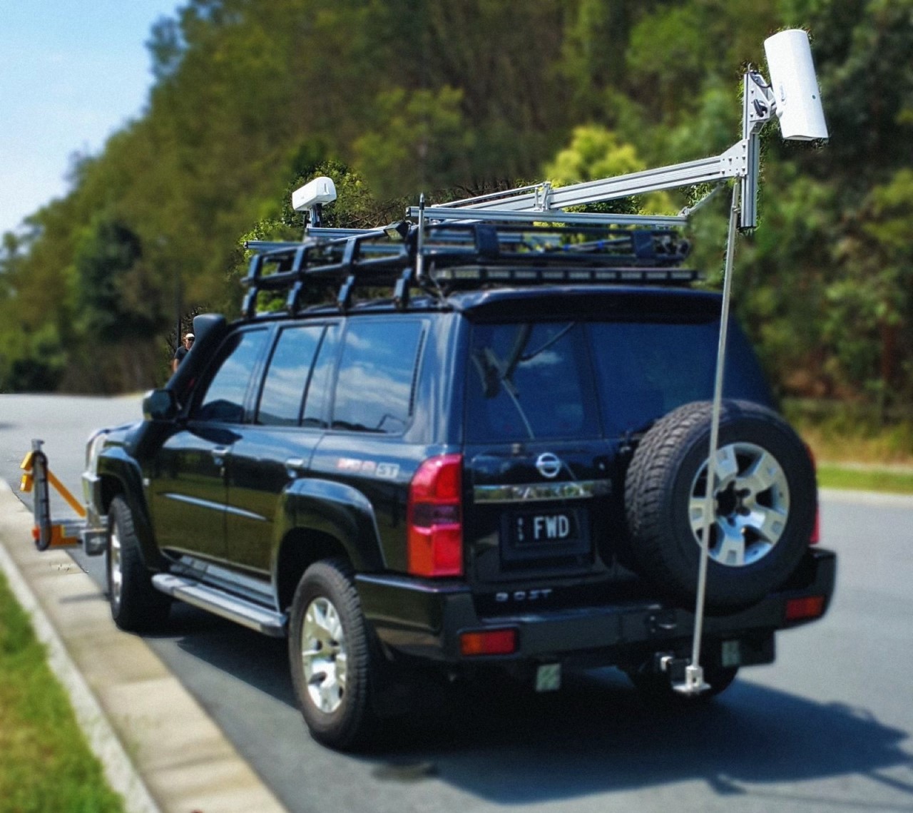
The ROMDAS Right of Way Video Logging module is used to create a visual record of the road right-of-way (ROW) to collect information about road asset and inventory. You can choose between high resolution single ROW cameras or the 360-view camera. The number of single ROW cameras can be customised and adjusted in the desired directions to suit project requirements.
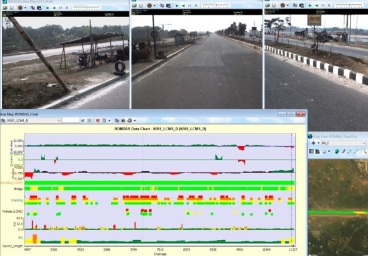
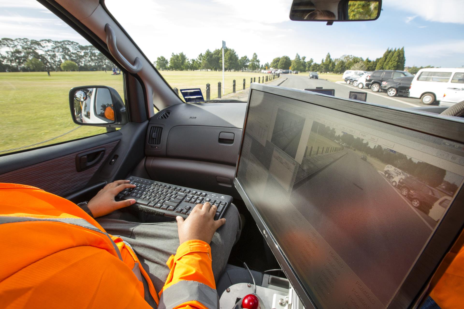
The ROMDAS Right of Way Video Logging module collects the road corridor images and directly digitizes them to output in standard JPEG or AVI format. These images are easy to view with most commonly used media players such as WMP, Quicktime, VLC, MPC, and many others. Users can define and customise the resolution and Images are recorded and stored on the survey computer at user-defined intervals to reduce file size (e.g. every 5 or 10m). As you conduct the survey, you can see the road images in real-time to constantly monitor the quality and aspect of the collected data.
ROMDAS Software features the option to overlay a range of data onto the recorded image. The data overlay is positioned above so the complete video image can be seen.
Learn about Pavement View Video
Key Benefits & Features
- Customizable image overlay referencing location and survey information
- User-defined trigger distance for reduced files sizes
- Real-time status display for immediate feedback on correct operation of the system
- Custom camera configurations available
- High resolutions images
- Roof mounted cameras offering better scope of view than dashboard mounted camera systems
- Additional cameras can be added to increase the range and scope of road asset or condition surveys
Data outputs
- Right Of Way Video Logging
- GIS maps extracted from survey imagery
- Standard .JPEG or .AVI image format