Support Road Survey

Road Survey Vehicle

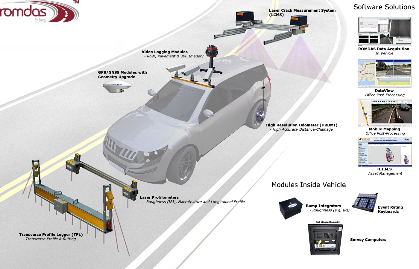
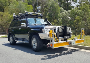
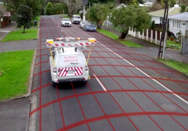
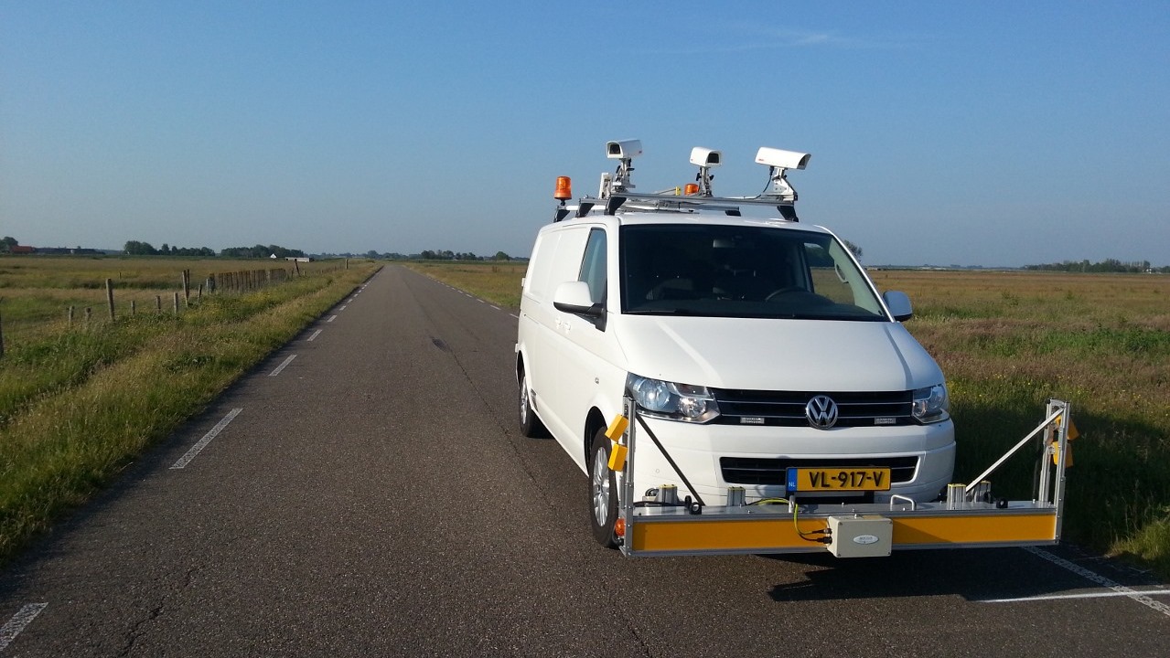
ROMDASTM has been developed as a cost effective and modular system designed to collect road and asset data using any vehicle

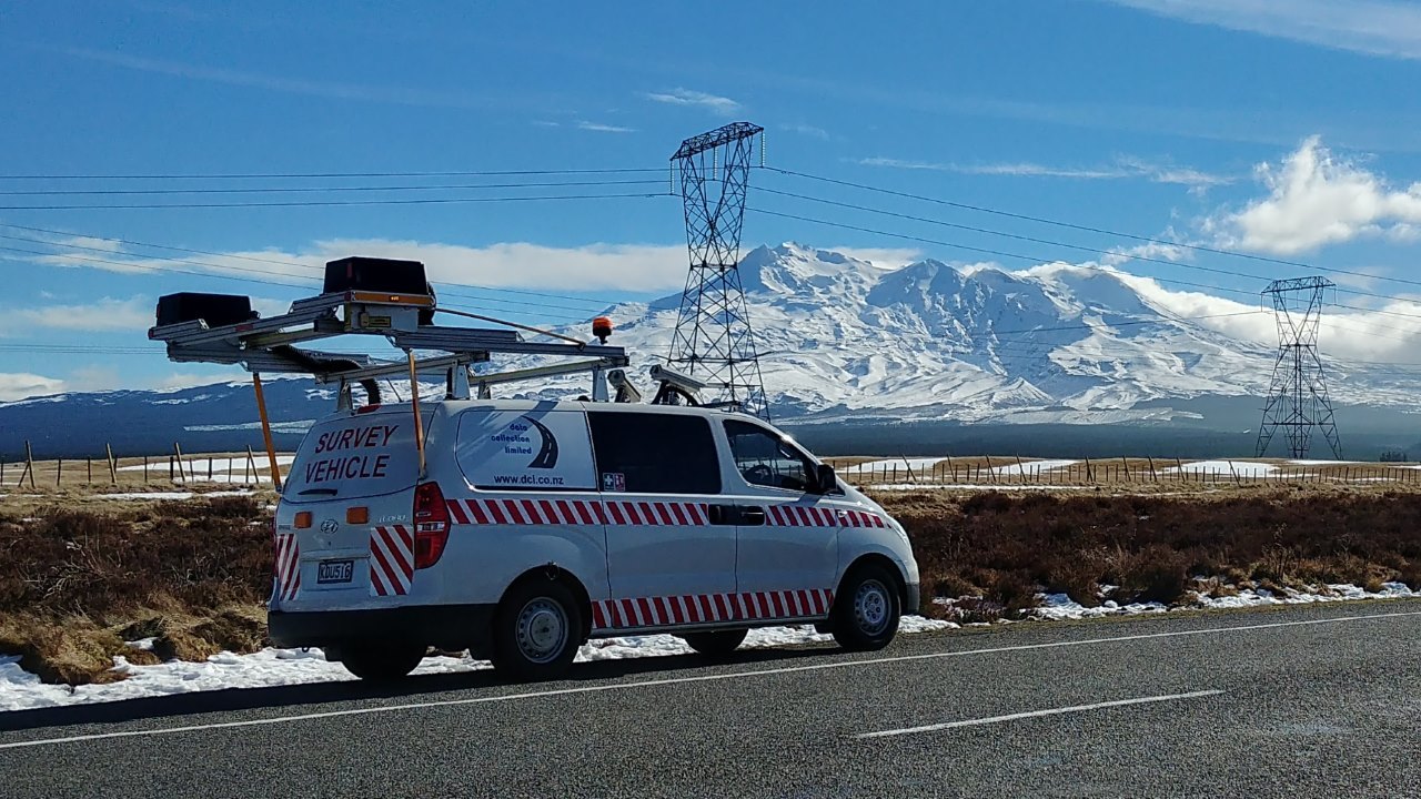
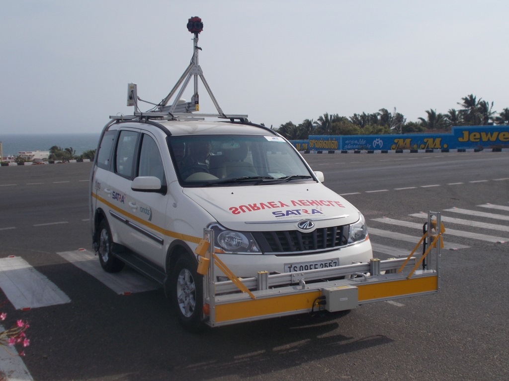
ROMDAS is a modular system developed to collect asset and pavement information using locally sourced road survey vehicles. Whether a private consultant, government department or research institution, ROMDAS’ design evolved with technology to offer great flexibility and ease of use to accurately measure a variety of pavement data quickly.

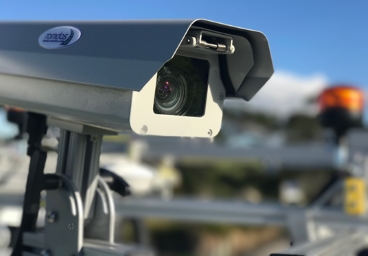
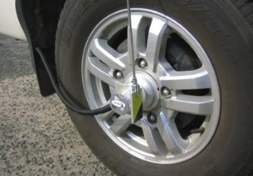
The Central ROMDAS system includes the core hardware components, odometer, interfaces and software licenses for collecting survey data. You can then add modules to this Central system for recording additional datasets. This innovative design can be installed on almost any vehicle. The system is designed to enable users to tailor it with modules specific to the needs of their projects, without having to spend their budget on components they do not need.

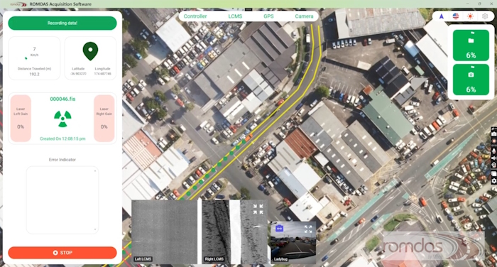
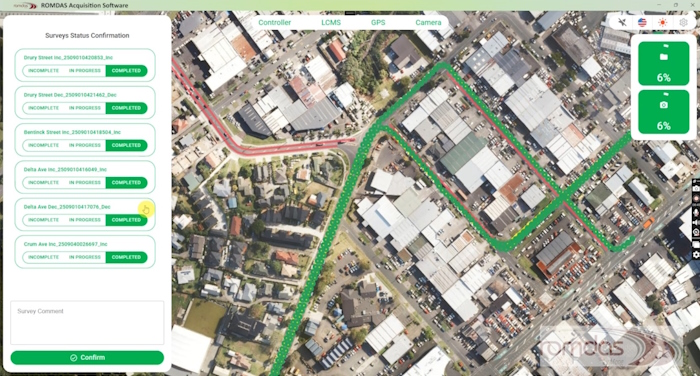
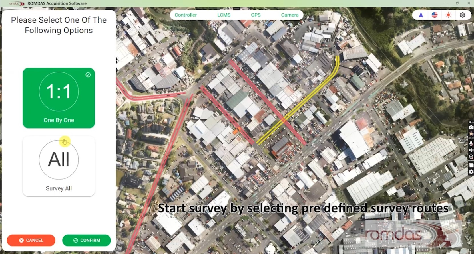
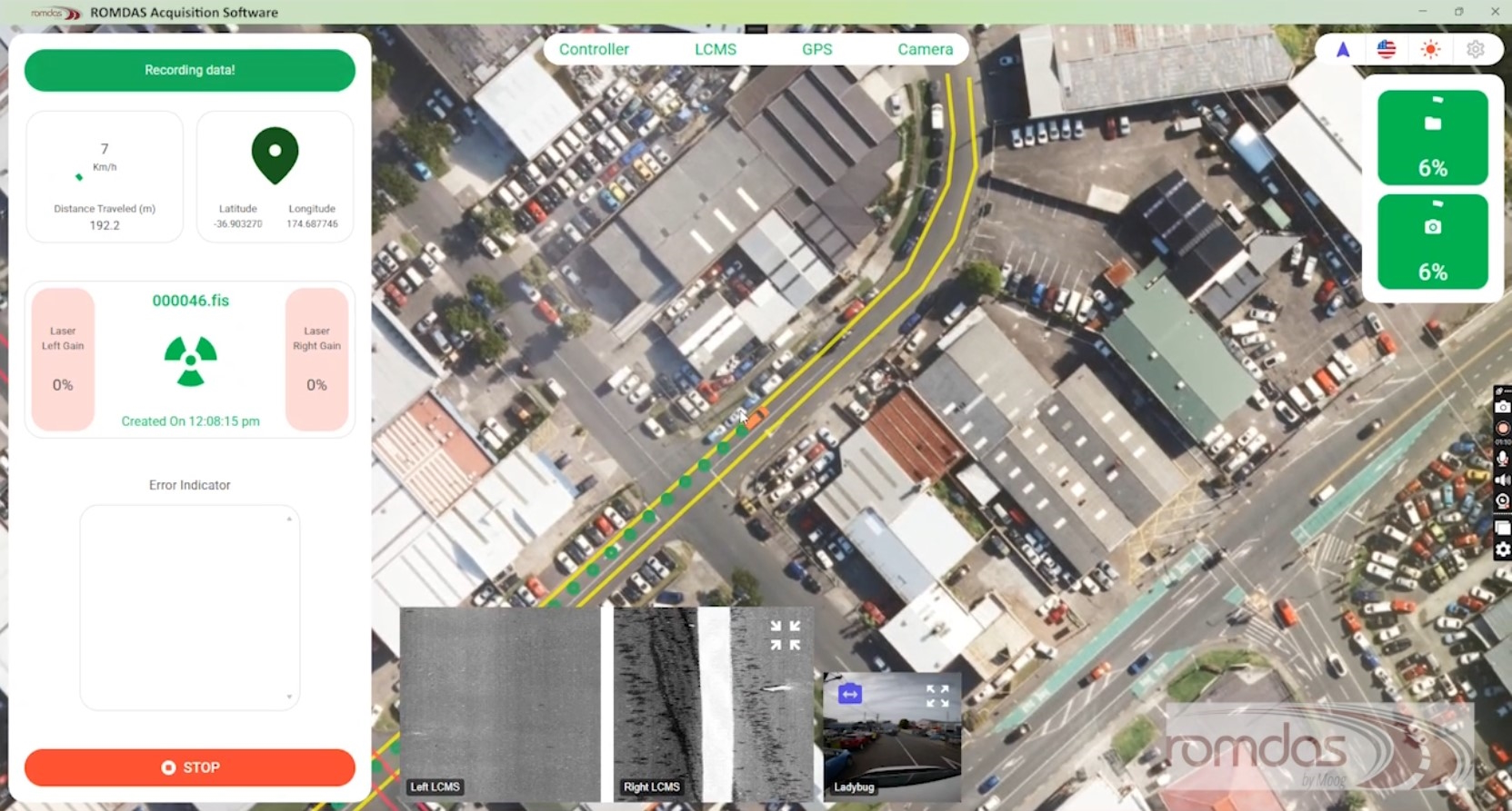
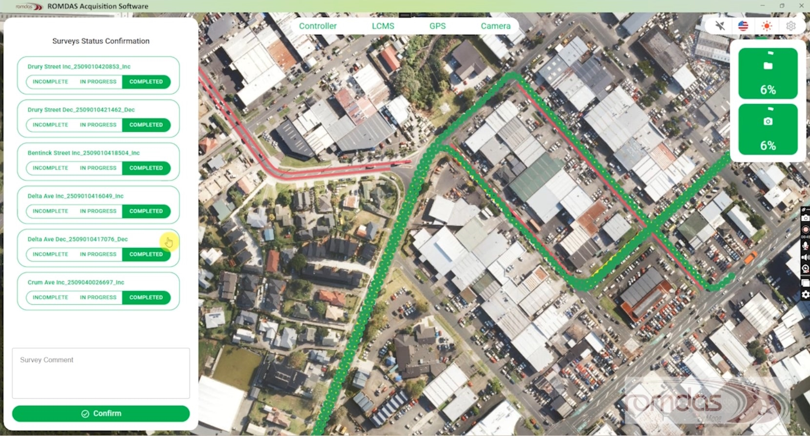
The interactive image below details the different modules available for the ROMDAS system. Hover your cursor over a specific module in the image to learn more.

Download System Overview View Completed Systems Watch VideoDesign a ROMDAS System

Pavement Condition Survey

Add-on Modules

ROMDAS offers low-cost devices for use in tough and unpaved conditions as well as the latest in laser scanning technology for accurate analysis of highways or rural roads

RAcq Data Acquisition Software

The Map-Based Data Acquisition Software Built for the Operator

RAcq Data Acquisition Software serves as the central interface between the survey computer and ROMDAS hardware to collect and analyze pavement data in real-time. Designed with a focus on operator efficiency, RAcq utilizes a map-based interface that allows users to monitor the vehicle's position, module status, and survey progress simultaneously.

The software streamlines field operations by providing a live visual record of all data collection activities. It is supplied with the central ROMDAS system and is used within the survey vehicle to record and process data into secure databases. RAcq ensures that every road network data is captured accurately, removing the uncertainty of field coverage and reducing the need for repeat surveys.

Key Benefits & Features

  • Live Map and Breadcrumbs: Track the vehicle’s movement in real-time. Digital "breadcrumbs" show exactly where data has been collected, ensuring 100% coverage.
  • Color-Coded Survey Status: The map updates instantly to show progress at a glance: Red for planned routes, Yellow for the current path, and Green for completed sections.
  • Smart Route Planning: Operators can upload CSV survey plans directly. The software then displays the exact roads to follow, reducing navigation errors and saving time.
  • Visual Odometer Calibration: Replaces complex manuals with an easy-to-follow, image-guided setup to ensure distance measurement remains accurate.
  • Offline Map Support: High-resolution maps can be pre-loaded to ensure full navigation and tracking in remote areas with no mobile network.
  • Customisable Display: Includes Day and Night modes for easy reading in any lighting conditions and supports multiple languages for global teams.
  • Real-Time Module Monitoring: Simultaneously monitor and control all ROMDAS modules to ensure all sensors are performing correctly during the survey.

Integrated Route Planning & Tracking

RAcq offers a powerful and flexible way to manage survey paths and ensure data integrity. Users can define specific routes and upload them so operators can follow a precise plan. In simple terms—if the operator can see the road on the map, they can see exactly what has been surveyed and what is left to do.

This visual approach eliminates the guesswork of manual logs. All progress is automatically referenced to distance/chainage and GPS coordinates, providing project managers with a transparent and auditable trail of all field work. This makes RAcq an essential tool for creating accurate inventories of assets, pavement conditions, and surface defects.

View Software Screenshots

Learn More About Our Products

We provide customers with innovative and cost effective data collection equipment

Road Roughness Measuring Instrument

Post-Processing Software

DataView 2 is a high-performance integration and post-processing platform designed to transform complex raw survey data into clear, actionable visual reports. This creates a seamless, unified workflow from the vehicle to the office.

Road Roughness Measurement

Add-On Modules

Customise a ROMDAS system by selecting from a range of add-on modules, including modules for Video Logging, Roughness, GPS, 3D Pavement Profiling, Mobile Mapping and more. Find the right configuration for your project.

Automated Foreign Object Detection

ROMDAS LFOD

Automated Foreign Object Detection. The ROMDAS LFOD system uses Pavemetrics LCMS hardware and latest algorithms for rapid FOD and pavement condition surveys at Airports.