Laser Foreign Object Detection (LFOD)
Combined Automatic Foreign Object Detection (FOD) and Pavement Analysis System for Airports
As air travel and freight expands, Airports are looking for automated and rapid solutions to ensure safer tarmacs. ROMDAS LCMS with LFOD is aimed at addressing this exact need for airports.
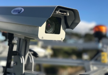
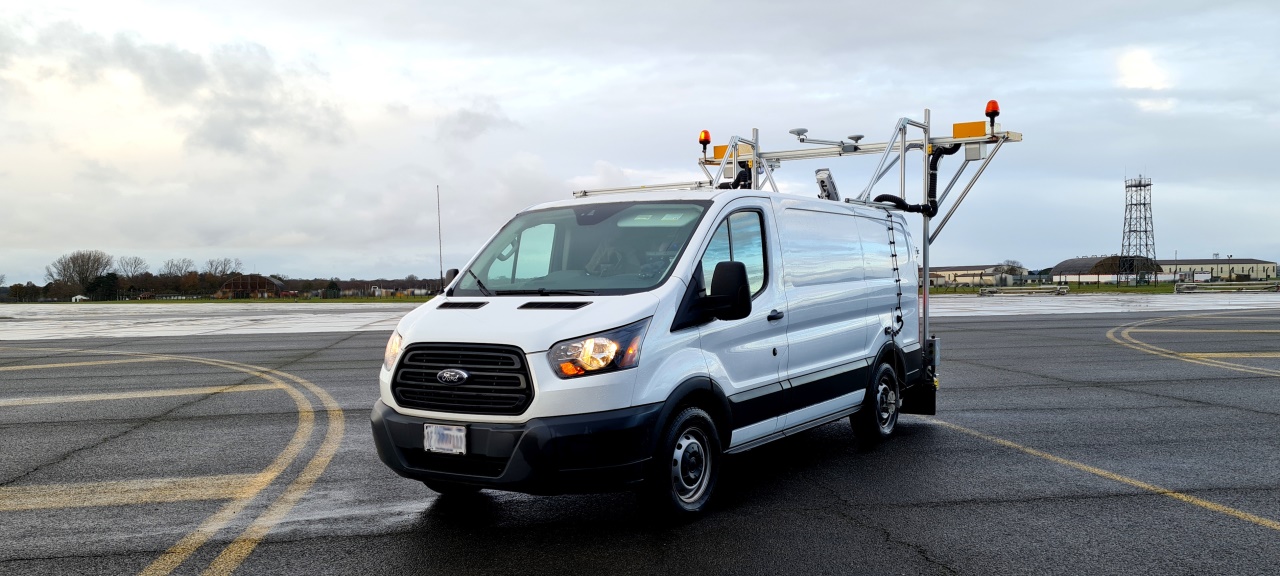
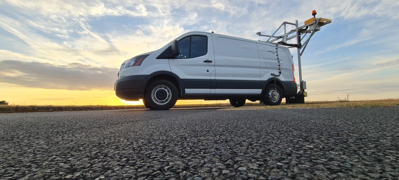
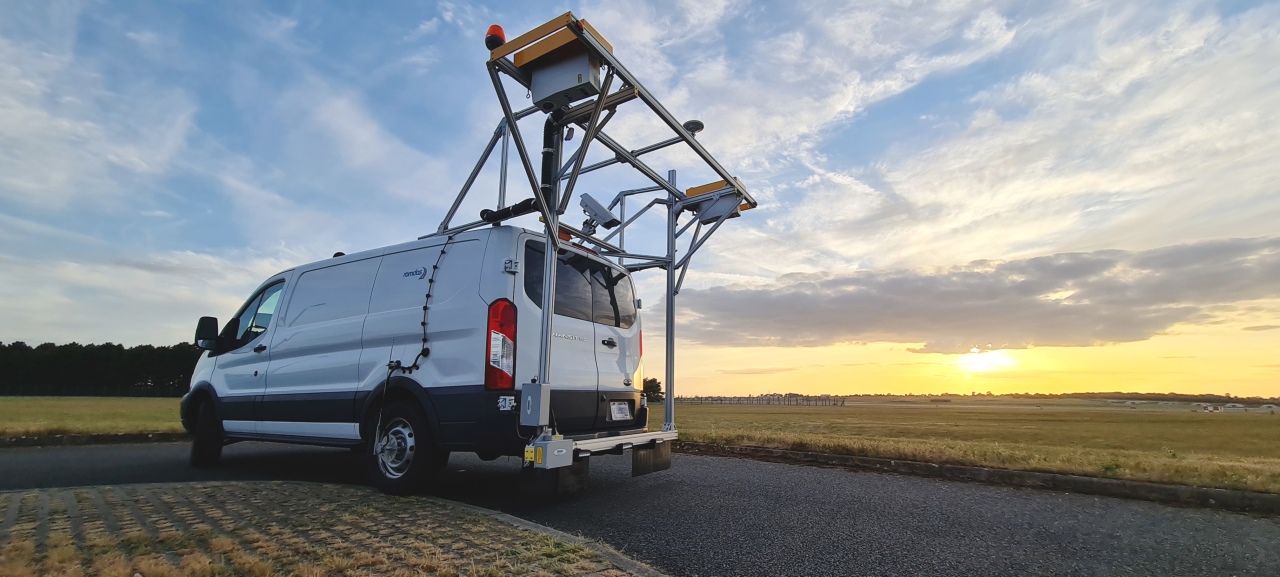
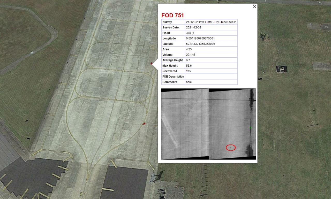
Mounted on a vehicle, ROMDAS LFOD system uses advanced 3D laser scanning technology and sub-meter GPS to automatically detect, give real time alerts, and archive FODs over an entire airfield. The system easily detects FODs of any material and colour, including loose aggregates. It also automatically generates GIS maps to identify possible hotspots for FOD management and prevention.
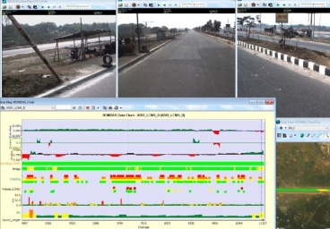
Unique to FOD systems, ROMDAS LFOD also collects wide variety of pavement condition data useful for effective airfield management. Compared to fixed systems, ROMDAS LFOD is a versatile and cost-effective tool for FOD and pavement management systems. This dual combination further increases the value and applicability of this system, especially for small or medium airports.
ROMDAS LCMS with LFOD system complies with the guidelines in FAA’s performance specifications for airport FOD detection equipment (AC No. 150/5220-24-2009).
Key Benefits & Features
- Rapid and flexible operations with mobile LFOD system
- Exceptional price compared to stationary ground-based systems
- No airside construction, roof mounted for increased mobility
- Scanning width of 5m per pass
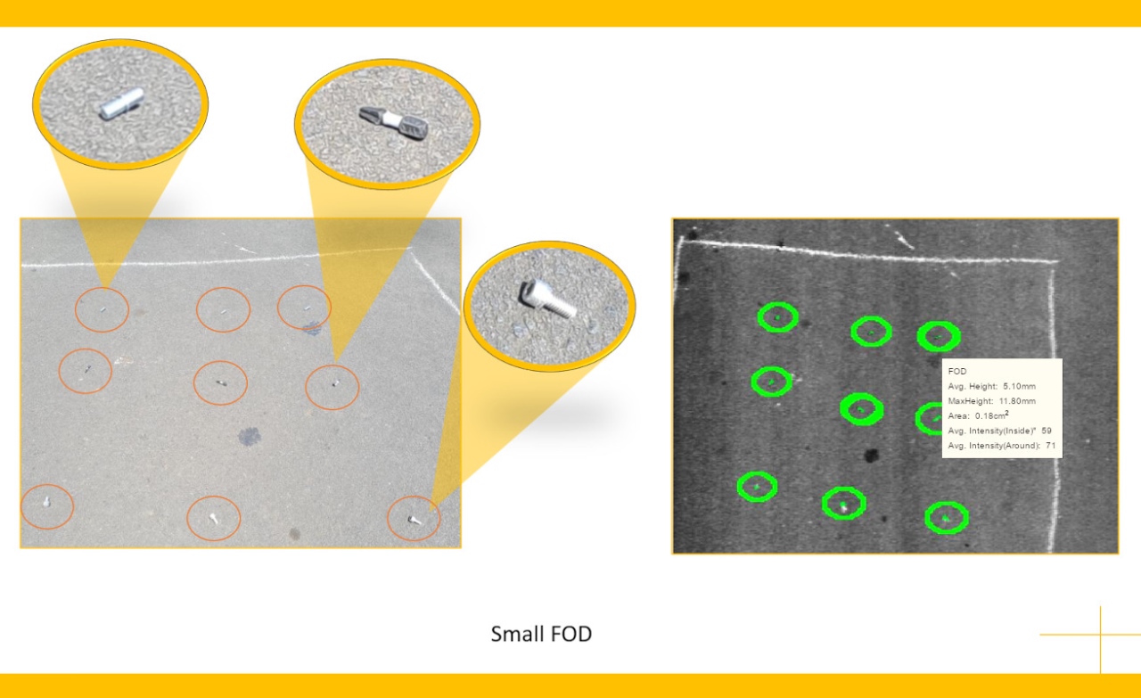
- Detects FOD as small as 5mm
- Real-time alerts in vehicle for specific FOD sizes
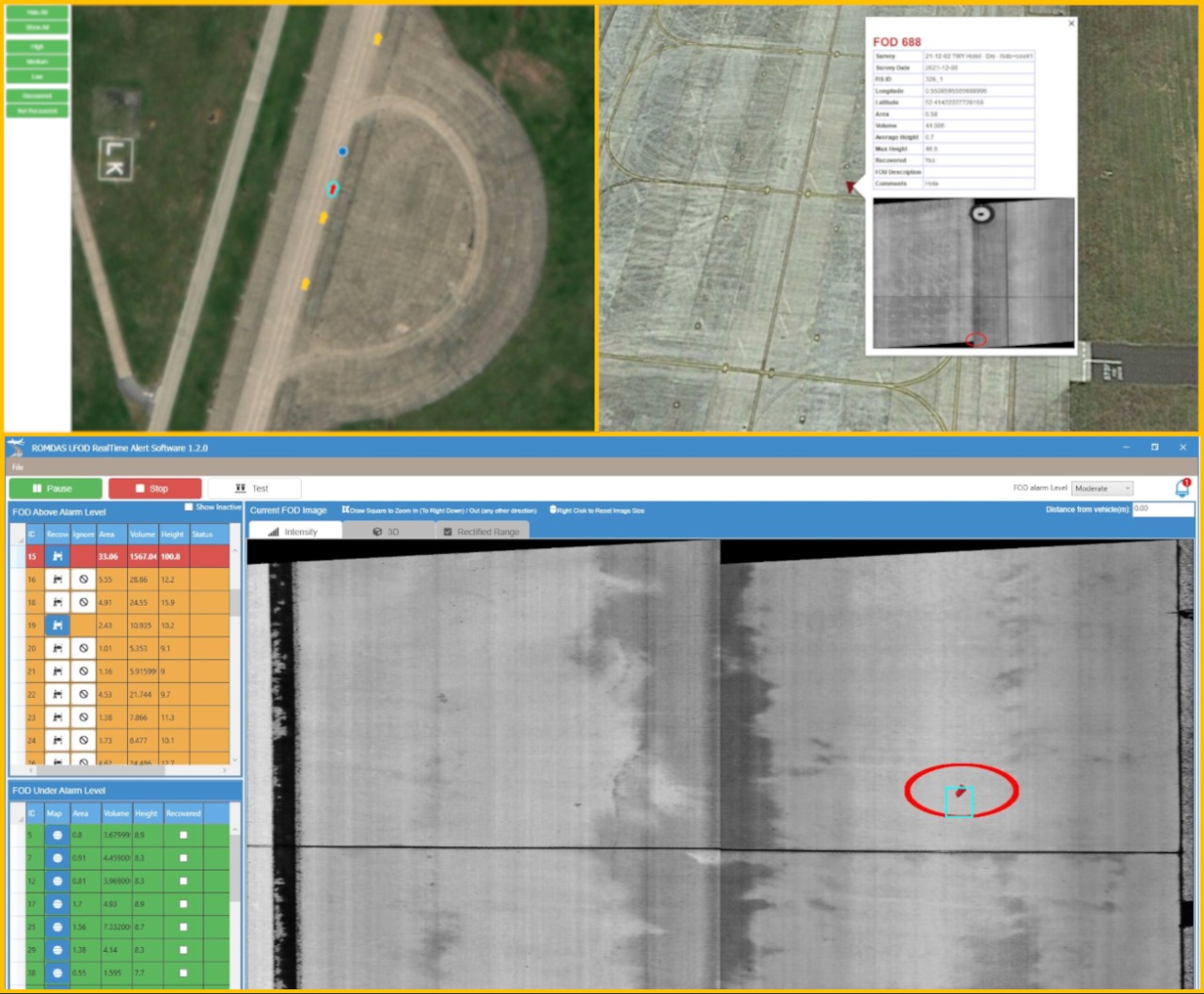
- User configurable alerts and severities
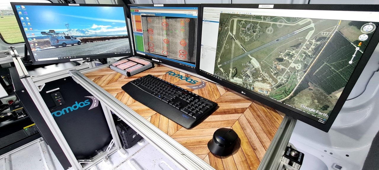
- Live map interface allows easy “find and retrieve” of potential FOD
- Operate in day or night conditions
- Operating speed 0-100km/h
- Accurate GPS tagging of FODs, <10cm GPS accuracy (when connected to RTX signal)
- Non-proprietary data formats; easy conversion to Excel, for GIS mapping or asset management systems
- Reprocess data using different parameters without re-surveying
- Add cameras and other modules to supplement LFOD data
- Meets all recommended FAA FOD inspection areas: runways, taxiways, aprons, aircraft servicing operations, air cargo operations, construction, aircraft maintenance activities (FAA AC: 150-5210-24)
Standard outputs
- FOD detection with location and dimensions
- Pavement condition such as cracking, ravelling, macrotexture, concrete joints, potholes etc.
- Geotagged Pavement images (.JPEG)
Optional Upgrades
- Longitudinal profile/Roughness (IRI and BBI in both wheel paths)
- Geometry (slope, cross-fall, radius of curvature, super elevation)
- LDTM Terrain Mapping .LAS files for CAD
