Inertial Navigation System (INS) for GNSS & Geometry Data

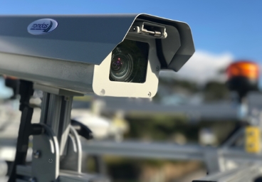
ROMDAS recently integrated GNSS unit with Inertial Navigation System (INS) to offer highly accurate and reliable sub-meter GPS coordinates, even during signal dropouts or outages. Now, this unit can also collect road geometry characteristics such as cross-slope, gradient, and radius of curvature.
This unit is integrated with inertial sensors and supports dual antennas for increased heading accuracy. This combination provides highly accurate and continuous position and orientation of the vehicle.
The INS device offers:
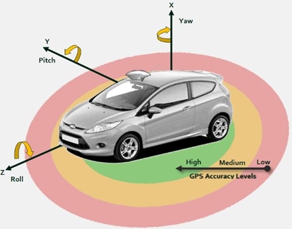
- Extremely high accuracy roll, pitch and heading positions
- Coordinates fills-in during signal drop-outs, aka Dead Reckoning
The above features allow ROMDAS software to leverage the positioning and orientation to collect, and then calculate, the geometry data values for the surveyed road. The Geometry Upgrade is a great addition to any ROMDAS system. If your ROMDAS system includes Mobile Mapping software, then it is required to extract highly accurate GPS coordinates for your assets and inventory.
Contact us today to enquire about the GNSS with INS Geometry Upgrade module.