LCMS2 passes NCAT Roughness Certification
LCMS-2 has successfully passed the National Center for Asphalt Technology’s (NCAT) rigorous longitudinal profiler certification process.
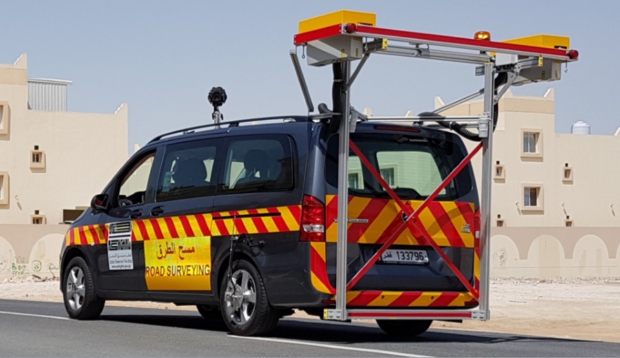
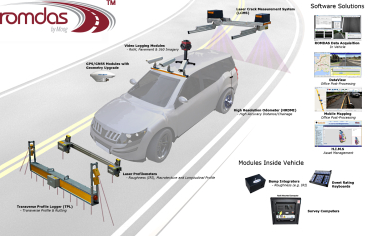
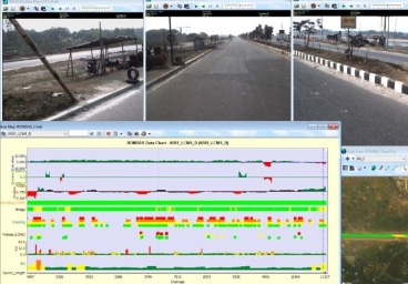
LCMS-2 has successfully passed the National Center for Asphalt Technology’s (NCAT) rigorous longitudinal profiler certification process. The scanning laser-based equipment is integrated with the ROMDAS system and is now becoming one of the popular modules as part of a complete ROMDAS Data Collection System.
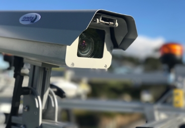
Well-known for automated surface defect detection, especially for high accuracy crack detection and measurement, the LCMS-2 maintains the same functional approach of LCMS-1 but delivering at five times the scanning speeds and three times of vertical accuracy. Add to that the power of internal Inertial Measurement Units (IMUs) which provide an incredibly precise longitudinal profile of the road. This will allow surveyors to eliminate associated costs and potential downtime because of a separate two-point roughness measurement subsystem.
The LCMS-2 is the true and only 3D laser surface profiler for automatic defect detection – on road, rail and airports. Passing the NCAT certification yet again validates Pavemetrics’ scanning laser-based technology for an accurate and repeatable inertial profiler, and be an alternative for the older roughness subsystem approach.
To know more about the capabilities of ROMDAS LCMS-2 system, you can write to us at sales@romdas.com or fill in the form to contact us.