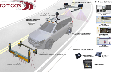
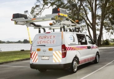
Mobile Mapping with ROMDAS Video Logging
Camera-based mobile mapping costs a fraction of systems such as LiDAR
LiDAR technology has shown itself to be an excellent tool for mapping and topographical surveying. It produces high accuracy georeferenced point clouds, often at a very long range. Its application for simply georeferencing roadside assets, however, has some practical drawbacks. It’s cost, processing time and specified GPS accuracy can make it impractical for GIS mapping and measuring roadside assets. This is why ROMDAS offers camera-based mobile mapping which can be more cost and labour efficient to capture this road corridor information.
Camera-based Mobile Mapping
Camera-based mobile mapping costs a fraction of systems such as LiDAR, and is an ideal solution for assets and defect measurements. Utilising high accuracy GPS positioning, camera based mobile mapping provides the expected outputs within a short time frame as it has low processing requirements for computer systems compared to LiDAR.
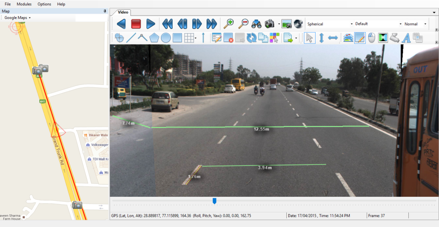
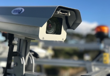
ROMDAS offers its Video Logging module with post processing software for mobile mapping to conduct right of way and pavement condition surveys. With camera-based mapping, the camera will collect the images at a defined intervals (e.g. every 5m or 10m) to reduce the file size yet capture all the relevant details. These images are directly digitized and output in standard JPEG or AVI format.
This makes it easy to view the images and videos in most commonly used media players such as WMP, Quicktime, MPC or VLC. Users can define custom resolutions, and images are shown in real-time during data collection to ensure the quality and aspect can be constantly monitored.
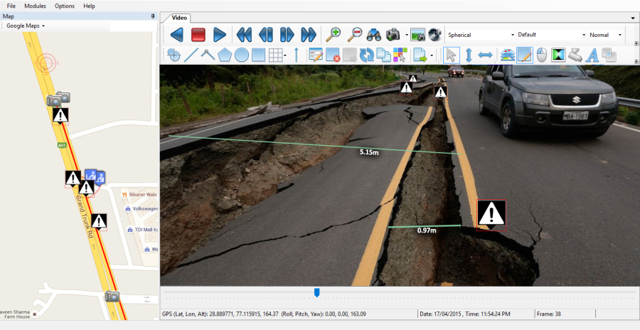
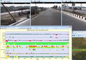
Using ROMDAS DataView post processing software, these images can be further analysed. DataView will synchronise all collected data in a central database, create custom graphs and strip maps, and capable of creating GIS map layers. We have also tied up with world renowned mobile mapping developers, Horus, to create a ROMDAS Mobile Mapping Software that will allow users to extract GPS coordinates of assets and events directly from the images.
To learn more about ROMDAS modules, software and on-going promotions, contact our Sales team.