DCL Team Surveys North NZ
Data Collection Limited’s survey team are currently conducting this year’s pavement condition survey
Location: Whangarei, New Zealand
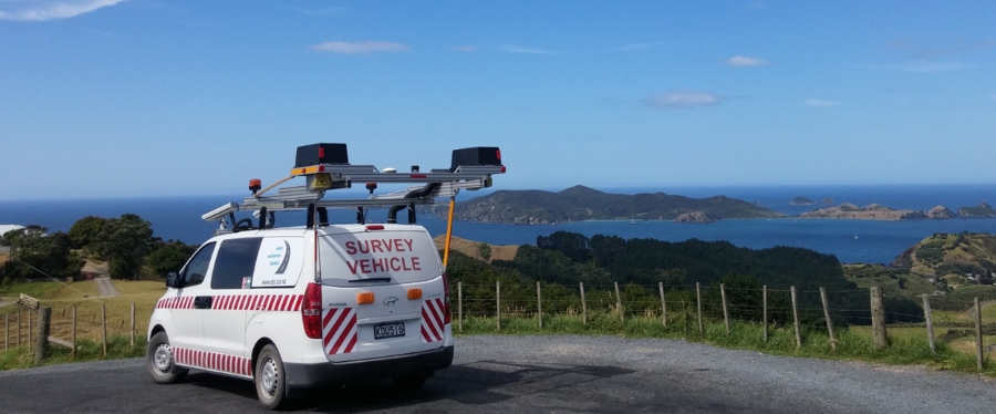
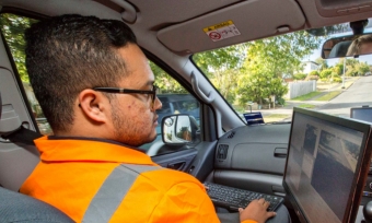
Data Collection Limited’s (DCL) survey team’s Athir Jappie and Sreenath Mavaram are currently conducting this year’s pavement condition survey for the Whangarei District Council (DC), Far North District Council, and Kaipara District Council, all part of the Northland Transportation Alliance (NTA).
Northland Transportation Alliance and DCL
Whangarei DC trialled the pioneering use of automatic crack and pothole detection from scanning lasers back in 2013-2014. New to New Zealand at that time, the Council was highly satisfied with this investment and rolled it out in 2015-2016 to the Far North and Kaipara DC’s as well. All Councils have since opted for the automatic cracking data in all subsequent years (along with the more traditional high-speed data sets).
About the Survey
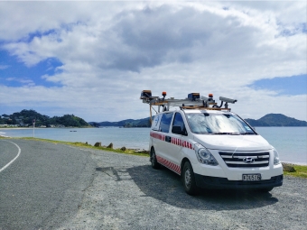
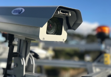
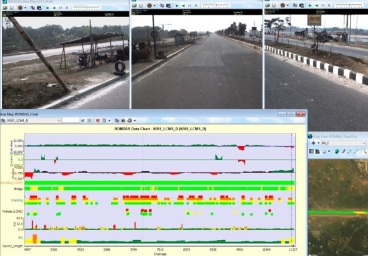
Each year the survey is conducted along approx. 4500 lane km of sealed pavements throughout the NTA network; which includes both urban and rural roads. The survey is conducting utilising two Laser Crack Measurement System (LCMS) scanning lasers. Deliverables include the automatic detection for roughness, rutting macrotexture, cracking and pothole data from the LCMS, as well as video imagery for right of way with GPS coordinates. The survey is conducted during New Zealand’s summer, meaning dryer weather conditions required to conduct the laser-based survey.
There are two main challenges for the team:
- The survey along high traffic volume areas had to be conducted off-peak times to reduce the likelihood of congestion, invalid data and to minimise the risk of incidents / accidents.
- The day-time survey was led by lighting conditions to ensure high quality video imagery with no sun flare. Within the built-up environment extra caution was required to ensure good quality images.
Collaboration and Cooperation
In the last year, the DCL survey team worked closely with Lonrix, makers of the JunoViewer (a web-based asset management system) to ensure that the datasets are integrated with the Council’s system. This has been led by the NTA who see great value in our data. Our video imagery is now integrated into Council’s JunoViewer system and DCL / Lonrix and now working on the integration of the LCMS images. This is good news for our other clients who also work with JunoViewer.
DCL has worked closely with the NTA over the years to ensure high quality data for all Councils which are used in modelling and NTA’s forward works programmes.